With 28,000 residents in 2011, Douglas was larger than the next four settlements added together.
The following images and notes offer very brief coverage of the contents of the Isle of Man Population Atlas. Click on images to enlarge.
Chapter 2: Population Distribution.
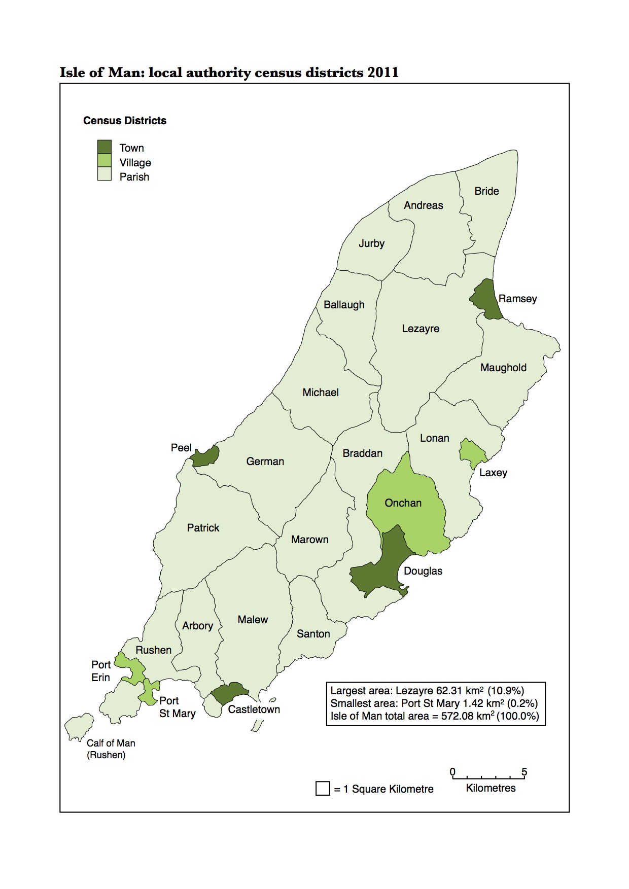
The Isle of Man holds a full census in years ending in 1. The last full census was in 2011. An 'interim census', with fewer questions and tables, is held in years ending in 6. The next interim census will be held on 24 April 2016.
This map shows the census districts, all of which are local authorities, that where used in 2011 and will also be used in 2016. The Island has four towns, four villages and sixteen parishes.
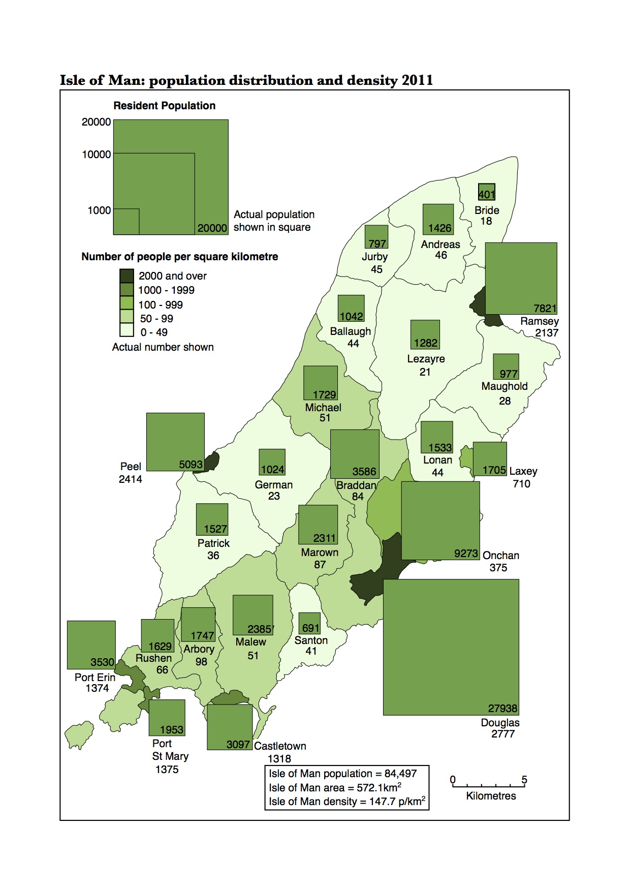
In 2011 the population of the Isle of Man was 84,497 on an area of 572.1 square kilometres giving an average density of 147.7 people per square kilometre. Douglas, with almost 28,000 residents was home to 33.1% of the Island's population and was larger than the next four most populous settlements (Onchan, Ramsey, Peel and Port Erin). The three settlements in the east of the Island (Douglas, Onchan and Braddan) together housed almost 41,000 people, 48.3% of the total population.
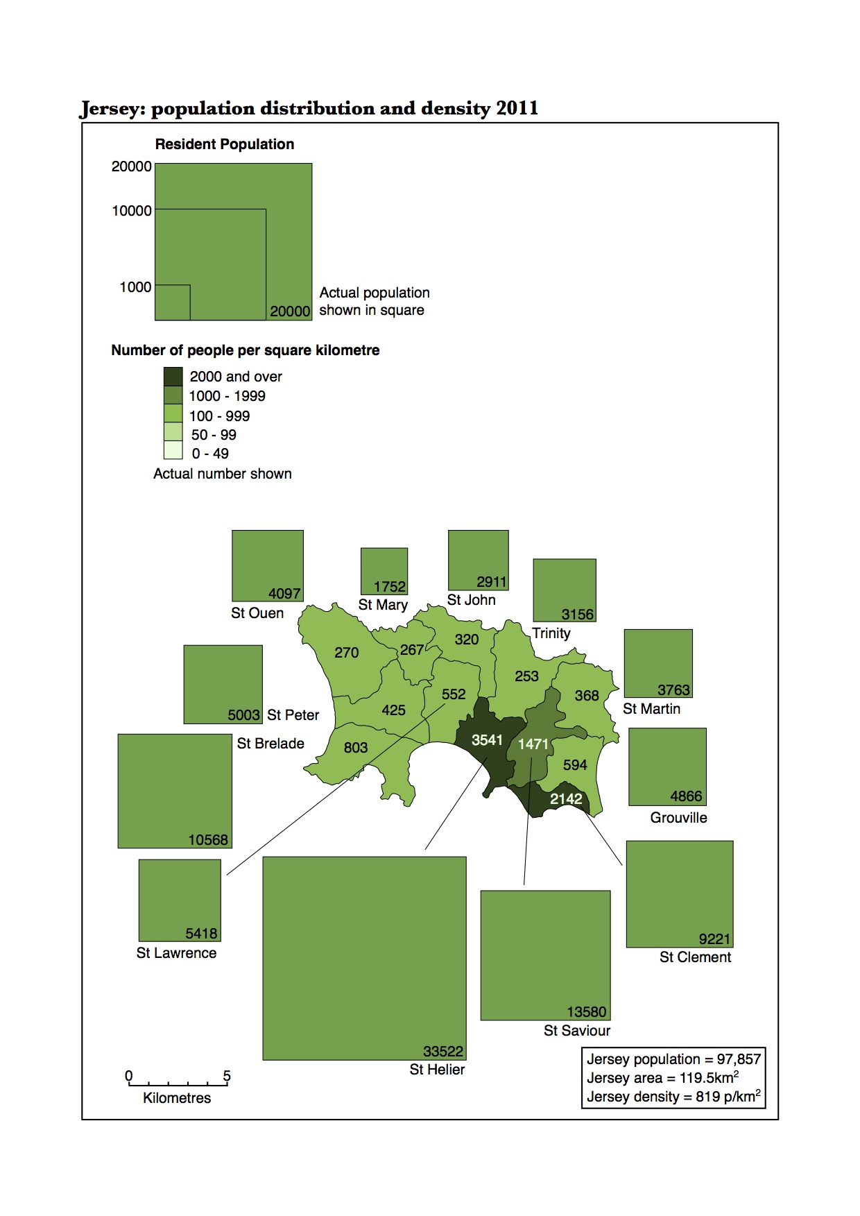
In 2011 the population of Jersey was 97,857 on an area of 119.5 square kilometres giving an average density of 819 people per square kilometre, over five and a half times higher than the Isle of Man. St Helier, with over 33,500 residents, was home to 34.2% of the Island's population, remarkably similar to the percentage of the Isle of Man's population living in Douglas.
The Isle of Man's four towns together had a population of nearly 44,000 in 2011. The combined population of the sixteen parishes was just over 24,000. The parishes covered over 91% of the Island's area but contained just 28.5% of the total population.
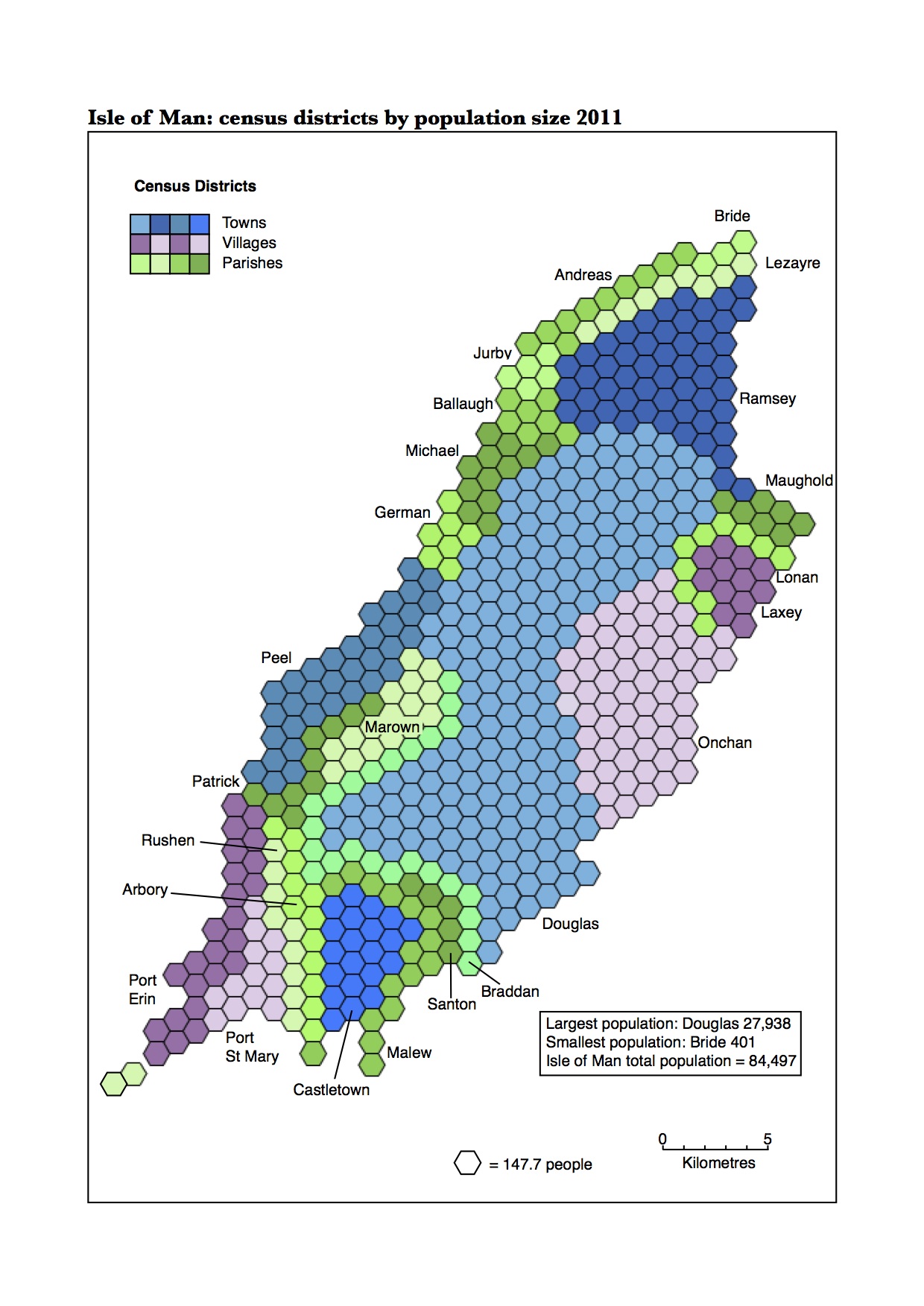
Douglas occupied less than 2% of the land area but contained 33% of the population. The eight towns and villages contained over 70% of the population in less than 10% of the Island's land area. At the other end of the graph, Bride, Lezayre, German, Maughold, Santon Patrick, Lonan and Ballaugh occupied almost 50% of the land area yet contained less than 10% of the population.

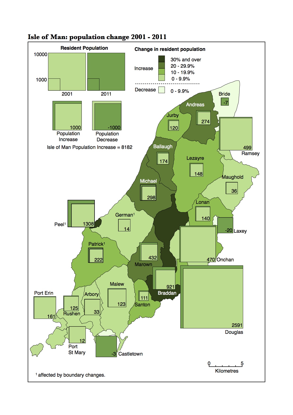
Between 2001 and 2011 the population of the Isle of Man increased from 76,315 to 84,497 (10.7%). Out of the 24 census districts, Douglas grew the most numerically, adding 2,591 residents. Peel and Braddan had the largest percentage increases in population at 34.6%.